Climate Change Impact Assessment
Climate Change Impact AssessmentAddressing climate change has become a critical issue both domestically and internationally. Effective countermeasures require a proper understanding of the impacts of climate change. We are conducting impact assessments of climate change on various hydrological phenomena.
1. Global-Scale Climate Change Impact Assessment
Atmospheric Reanalysis Data
Atmospheric reanalysis data are the results of numerical simulations by atmospheric models that have been assimilated with various observational data, often serving as a substitute for direct observations. Since atmospheric reanalysis data covers the entire globe, it allows for climate change impact assessment on a global scale, including regions with sparse observational data.
CMIP Future Climate Projection Data
For future climate projections, research institutions worldwide publish simulation results using GCMs (Global Climate Models) under common protocols through the CMIP6 (Coupled Model Intercomparison Project Phase 6), led by the IPCC. By combining these with SSPs (Shared Socioeconomic Pathways)—scenarios that assume future socioeconomic developments and environmental policies—it is possible to predict future climates including temperature rises corresponding to different societal scenarios. We are advancing global-level climate change impact assessments based on this CMIP6 data.
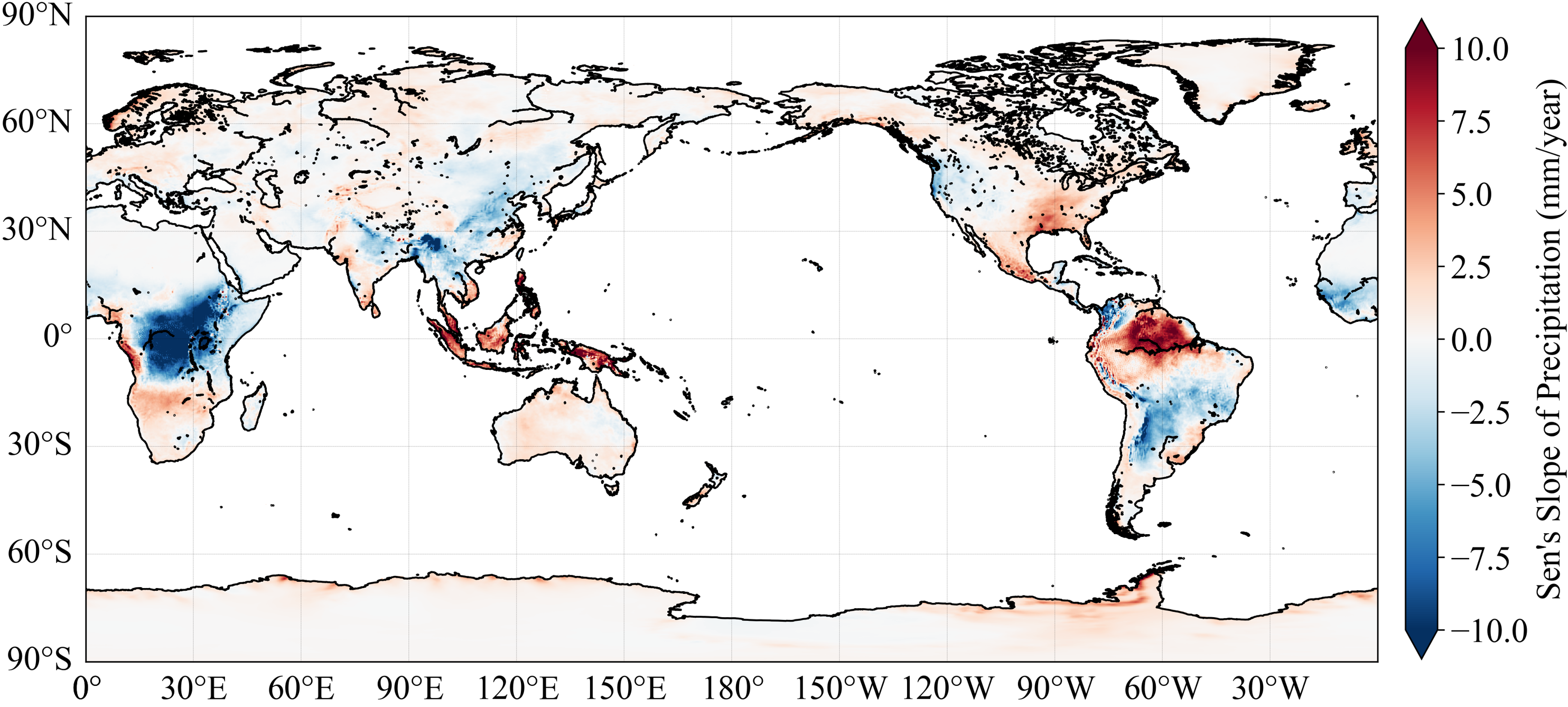
Changes in precipitation over the past period (using ERA5)
2. Future Prediction via High-Resolution Simulation
Dynamical Downscaling of Future Climate Projection Data
Future climate predictions are generally performed using GCMs. However, due to limited computational resources, GCMs often have horizontal resolutions of 100 km or more, which is too coarse for local or basin-level analysis. Furthermore, they cannot adequately represent atmospheric conditions during heavy rainfall events in Japan. Therefore, we perform dynamical downscaling using regional atmospheric models to achieve higher resolution.
Nationwide Simulation at 2km Grid
We are currently proceeding with dynamical downscaling to cover all Class A river basins across Japan. We divide the computational domain of the regional atmospheric model into multiple parts and adjust the model for the basins within each domain. Upon doing so, we proceed with the dynamical downscaling of future climate projection data. By conducting simulations at the high resolution of 2 km, it becomes possible to make future predictions that reflect Japan's complex topography.
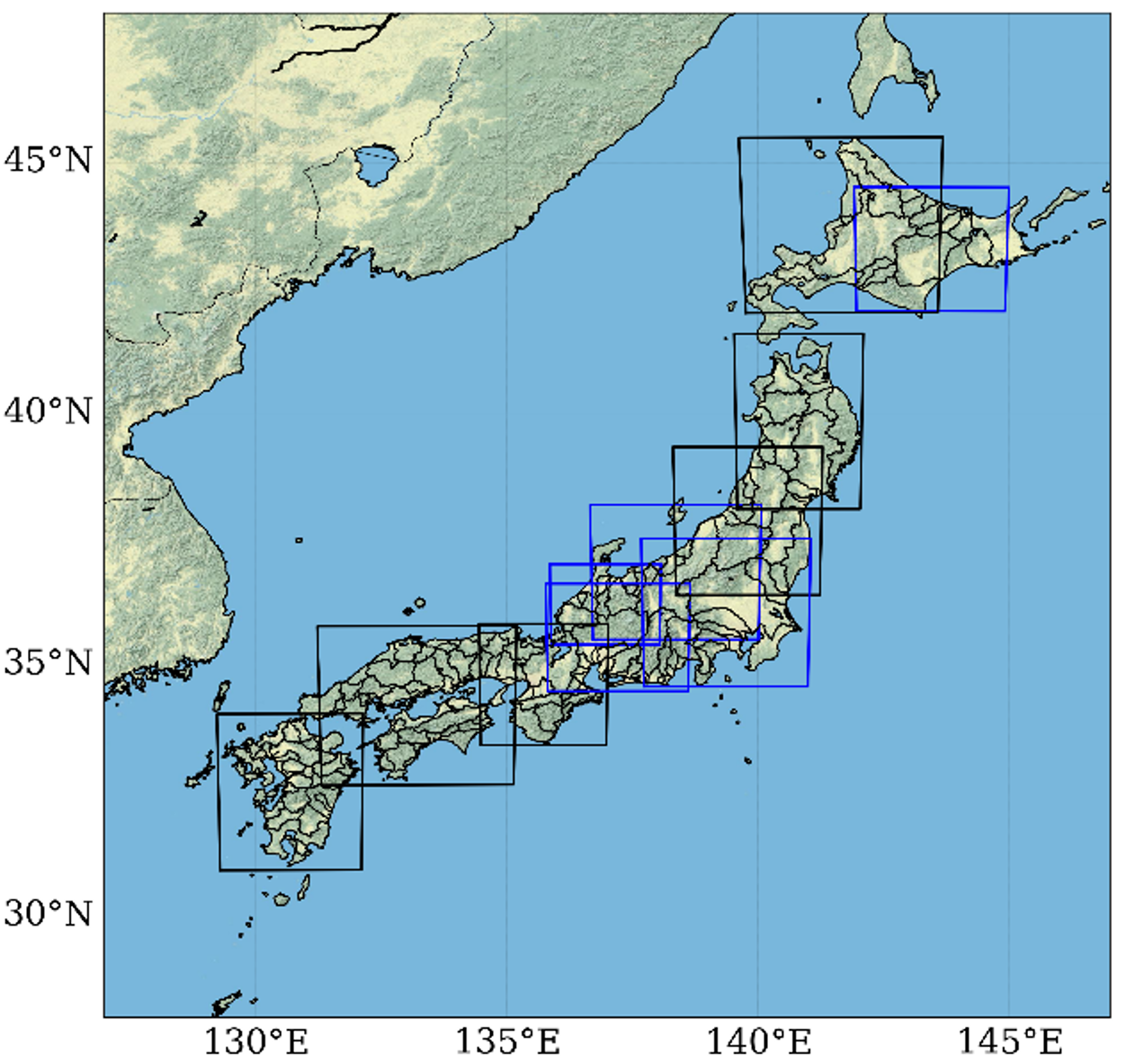
Computational domains covering all Class A river basins
3. Regional and Basin-Scale Impact Assessment Using Downscaling Results
The downscaled future climate projection data provides high resolution. Leveraging this advantage, we can conduct various impact assessments related to climate change at the regional and basin levels.
Impact on Precipitation
Precipitation is included in the output of the atmospheric models used for downscaling. When considering the water cycle, analyses often begin with precipitation.
Impact on Snow Accumulation and Melting
The processes of snowfall, accumulation, and melting are significantly affected by rising temperatures. in regions with snow accumulation, snowmelt water often serves as a valuable water resource from spring to early summer. Changes in the timing of snowmelt due to global warming can cause major issues.
Changes in River Discharge
In addition to changes in precipitation and snow accumulation/melting, river discharge is also affected by climate change through evapotranspiration and other factors. Therefore, changes in precipitation do not directly translate to changes in river discharge, necessitating individual analysis.
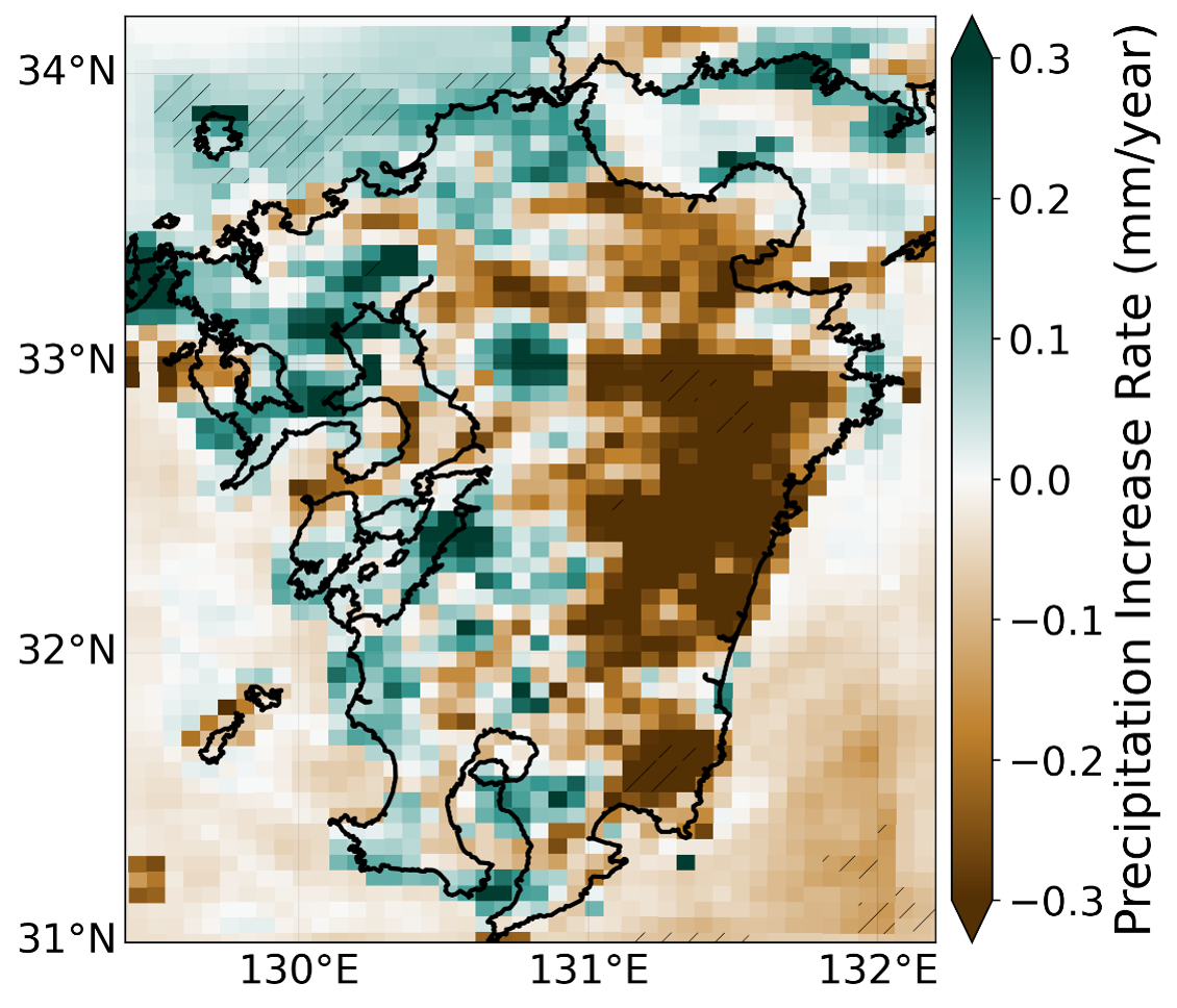
Future changes in precipitation
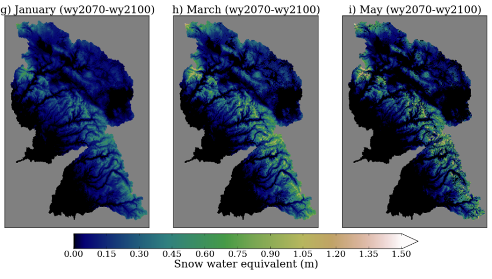
Future changes in snow accumulation (Ishida et al., 2018)